Data Flow from Space to Earth: Applications and Interoperability
From 21 to 23 March 2011, at the Veneto Institute of Science, Letters and Arts at Franchetti Palace, the CORILA – an association that promotes and coordinates research on the Venetian lagoon – organized the scientific conference entitled „From Space to Earth“, in collaboration with the Veneto Region and with different research institutions and European organizations, including UNESCO, ESA, Nereus, Ispra, CNR, OGS.
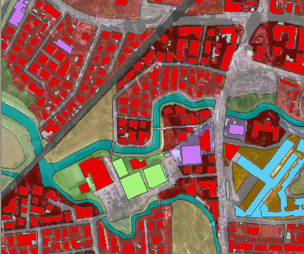
The conference had as its focus the use of satellite data for environmental management and started from consideration that, although in recent years have greatly increased the ability to observe the Earth from space, the data collected by satellites are used only in small percentage. What causes it? „Surely a little application development,“ says Pierpaolo Campostrini, director general of Corila „But also a lack of standardization of how this information is acquired, therefore a difficulty in their use.“. The conference was born from the need to promote greater development and use of space applications: services from Earth observation systems, navigation and positioning, especially account for the European GMES program which is already providing various services to EGNOS satellite navigation system that is operational, the Galileo constellation, which will soon be a reality. No less important is the issue of integration of satellite data with Geographic Information Systems and interoperability of spatial data, according to the INSPIRE Directive. „The intention is therefore to understand what are the conditions to encourage better use and therefore a broader market of this information.“ adds Campostrini. „We are convinced, along with the European Commission, which by this type of information may arise in applications can improve the quality of life of European citizens, for example at the level of security, but also advantageous from a standpoint of economic development.“ The conference has been structured on four parallel tracks. „A conference devoted not only to scholars but also to users in the industry“ said Campostrini „because these applications have a practical use in the governance of land and environment, as well as be a stimulus for research of the innovation.”

Author: Silvano De Zorzi
 From 21 to 23 March 2011, at the Veneto Institute of Science, Letters and Arts at Franchetti Palace, the CORILA – an association that promotes and coordinates research on the Venetian lagoon – organized the scientific conference entitled „From Space to Earth“, in collaboration with the Veneto Region and with different research institutions and European organizations, including UNESCO, ESA, Nereus, Ispra, CNR, OGS.
The conference had as its focus the use of satellite data for environmental management and started from consideration that, although in recent years have greatly increased the ability to observe the Earth from space, the data collected by satellites are used only in small percentage. What causes it? „Surely a little application development,“ says Pierpaolo Campostrini, director general of Corila „But also a lack of standardization of how this information is acquired, therefore a difficulty in their use.“. The conference was born from the need to promote greater development and use of space applications: services from Earth observation systems, navigation and positioning, especially account for the European GMES program which is already providing various services to EGNOS satellite navigation system that is operational, the Galileo constellation, which will soon be a reality. No less important is the issue of integration of satellite data with Geographic Information Systems and interoperability of spatial data, according to the INSPIRE Directive. „The intention is therefore to understand what are the conditions to encourage better use and therefore a broader market of this information.“ adds Campostrini. „We are convinced, along with the European Commission, which by this type of information may arise in applications can improve the quality of life of European citizens, for example at the level of security, but also advantageous from a standpoint of economic development.“ The conference has been structured on four parallel tracks. „A conference devoted not only to scholars but also to users in the industry“ said Campostrini „because these applications have a practical use in the governance of land and environment, as well as be a stimulus for research of the innovation.”
Author: Silvano De Zorzi
