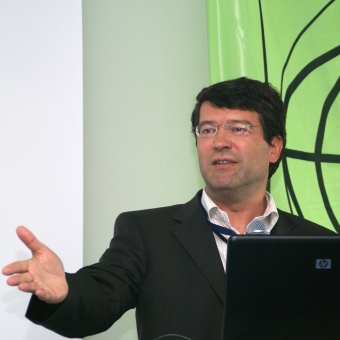
V seriálu „Významné osobnosti světové geoinformační scény“ se vám snažíme přinášet rozhovory s lidmi, kteří mají vliv na to, co se v geoinformatice a kartografii děje. Jedním z nich je bezpochyby i Georg Gartner. Profesor Georg Gartner (1966) působí na Technické Univerzitě ve Vídni, kde získal jak titul v oboru geografie-kartografie, tak i PhD. Je editorem časopisu Journal on LBS a má za sebou výzkumné pobyty v USA, Číně či Austrálii. V současné době zastává post prezidenta Mezinárodní kartografické asociace (ICA). Vychutnejte si zatím náš nejdelší rozhovor, jehož původní verzi naleznete v naší anglické mutaci.
Jaké největší změny podle Vašeho názoru ovlivnily GIS/kartografii za posledních deset let?
Je pochopitelné, že vývoj nových technologií a jejich lepší dostupnost mají největší dopad. V oblasti správy geodat se objevilo několik nových technologií, které měly přímý a nebo nepřímý dopad na kartografii. Mezi tyto technologie lze počítat sběr, modelování a zpracování dat, stejně tak jako kartografické způsoby vizualizace a distribuce. Jako příklad mohou sloužit technologie pro sběr dat, například laserové skenování, Range Cameras či satelitní snímky s vysokým rozlišením, které dokáží iniciovat další projekty (např. Rapid Mapping pro rychlé kartografické výstupy v případě živelných katastrof). Mezi další příklady patří service-oriented architecture (SOA), Cloud Computing nebo Real-Time Data Streaming.
Další velkou změnou v kartografii je nástup pojmu “neokartografie”, který se čím dál tím více rozšiřuje jako popis aktivit v moderní internetové kartografii. Jiní užívají termín VGI, aby popsali specifickou vlastnost uživatelů, kteří jsou ochotni sdílet geografické informace. V projektu OpenStreetMap uživatelé nejenže sdílí informace, které posbírali pomocí GPS přístrojů, ale také dodávají atributové informace k těmto prostorovým datům. Dále zde jsou projekty, které umožňují sdílet geografické informace skrze jednoduché a příjemné prostředí webu 2.0 jako například Google Maps nebo Google Earth.
Velká diskuze se v poslední době točí kolem role uživatelů jako tvůrců vlastních map. Očividně zde existuje poměrně velká skupina uživatelů, kteří mají zájem o tvorbu vlastních map či vizualizovat vlastní data. Také zde existuje velká skupina uživatelů, kteří jsou ochotni věnovat velké množství času jako dobrovolníci. Mimo fakt, že takto generovaná data a mapy jsou různé kvality a občas nesplňují kartografické standardy, trend přesunu uživatelů z pozice konzumentů do pozice tvůrců je enormní. Z toho vyplývá, že je nezbytné, aby tradiční kartografie vytvořila a přijala uživatelsky jednoduché nástroje, aby byla zajištěna alespoň minimální úroveň výsledných map.
Jaké změny nás podle Vaše názoru čekají v oblasti GIS/kartografii v následujícíh deseti letech?
Nejprve je potřeba podívat se na výzvy, kterým současná kartografie čelí, ať už je to tvorba kartografických modelů v téměř reálném čase, či nutnost integrace kartografických výstupů do různých mobilních zařízení. S ohledem na tyto výzvy zde existuje potřeba efektivnějších presentačních schémat pro jednotlivé situace. V dnešní době jsou dostupné různé prezentační modely – 2D, 3D, animace, apod. Mapy jsou velice silným nástrojem komunikace a nový trend personalizace se tedy objevuje i v tomto sektoru. Tato změna obsahuje také například kolektivní tvorbu map skrze crowdsourcing a VGI. Vzhled map v oblasti Web Mappingu 2.0 je v současné době velká výzva a to především s ohledem na omezení, která nám kladou displeye jednotlivých zařízení a používání internetu.
Kartografové se v poslední době snaží navrhnout nové vzhledy pro moderní webové mapy, které by kombinovaly jak interaktivní uživatelské prostředí, tak efektivní komunikaci prostorových informací a zároveň by byly estetické. Uživatelé internetu nemusí být nutně odborníci na kartografické principy, proto jejich mapy často končí jako nečitelné a s nevhodným vzhledem. Přesně z tohoto důvodu je zde potřeba najít balanc mezi kartografickými principy a možnostmi pro uživatele, jak si upravovat vlastní mapy na webu.
Ve skutečnosti i internet čelí nové výzvě ve svém vývoji, protože se může stát součástí každodenního života všech. V dnešní době dokonce i přístroje, které používáme běžně (pračka, alarm domu, osvětlení, aj.) jsou schopny komunikovat bezdrátově prostřednictvím miniaturních senzorů a procesů. Výrazy jako “pervasive computing” či “ubiquitous computing” popisují integraci informačních technologií v obytných prostorech a našem životě.
Na základě mého předchozího komentáře se domnívám, že bezdrátové technologie a mikroelektronika jsou klíčové technologie pro “chytrá místa” a “chytré věci”. I když je možné využít geo-senzorové sítě (GSN) sestávající z mnoha malých, elektronických, levných zařízení, která umí sledovat jejich okolí, plnit jednoduché kroky ve výpočtech a vzájemně komunikovat. Takové geo-senzorové sítě budou v budoucnu zajímavé, stejně tak i automatizované metody získávání dat v různých oblastech použití.
Z kartografického hlediska mají velký význam inovativní infrastruktury pro přenos informací. Všude dostupná mobilní zařízení, která dokáží komunikovat skrze bezdrátové sítě, lze použít na podporu kartografických procesů. Je více a více realistické, že interaktivní, real-time, všudypřítomné a LBS kartografické komunikační procesy, které jsou kdykoliv připravené k využití, se budou dále vyvíjet. To by umožnilo kontextový a individuální přenos geodat a kartografických výstupů. Taková míra individuality by vedla k řešení prostorových úloh na mírů uživatelům. Jako příklad můžeme uvést prostředí, které samo o sobě podporuje uživatele v pochopení prostoru, ve kterém se nachází, a podporuje jej v hledání cesty.
Myslíte si, že klasická papírová mapa je již mrtvý produkt?
Zmizely noviny po tom, co se objevila na trhu televize? Zmizela televize poté, co byl představen Internet? Stejný typ otázky je platný i s ohledem na papírové mapy. Pevně věřím, že to není otázka, které médium je či bude nahrazeno, ale spíše které médium je nejvhodnější pro konkrétní úkol v konkrétním kontextu. V tomto chápání je papír jako nástroj na tom stejně, jako dříve zmíněné nástroje komunikace (radio, TV, internet), a pro určité způsoby využití může být ten nejvhodnější a preferovaný typ média i v budoucnosti.
Takže podle mého názoru papírové mapy nejsou mrtvé.
Když jdete na hory, používáte papírové mapy nebo GPS a tablet?
Papírové mapy.
Kdo jsou hlavní partneří ICA (Mezinárodní kartografická asociace) ze soukromého sektoru (mimo Esri a Intergraph)? Spolupracuje ICA nějakým způsobem s velkými společnostmi typu Google, Microsoft či Apple?
Mezinárodní kartografická asociace (ICA) funguje na principu národního členství, tzn. máme národní zástupce. Většinou se jedná o zástupce národních kartografických společností či podobných orgánů. V rámci těchto zástupců však máme i zástupce průmyslových partnerů. Vedle toho má ICA také přidružené členy, z nichž někteří jsou soukromé společnosti. Uvedené společnosti Google, Microsoft a Apple nejsou přímými členy ICA, ale občas mívají zástupce na setkáních jednotlivých komisí či na konferencích.
Můžete jmenovat 3 nejdůležitější vynálezy v GIS/kartografii?
Z technologického pohledu bych řekl: mědiryt, databázově řízená kartografie a internetová kartografie. Z produktového pohledu potom atlasy, topografické mapy a Google Maps.
Georg Gartner is a Full Professor for Cartography at the Vienna University of Technology. He holds graduate qualifications in Geography and Cartography from the University of Vienna and received his Ph.D. and his Habilitation from the Vienna University of Technology. He was awarded a Fulbright grant to the University of Nebraska at Omaha in 1997 and a research visiting fellowship to the Royal Melbourne Institute of Technology in 2000, to South China Normal University in 2006 and to the University of Nottingham in 2009. He serves as President of the International Cartographic Association. He is Dean for Academic Affairs for Geodesy and Geoinformation at Vienna University of Technology. He is responsible organizer of the International Symposia on Location Based Services & TeleCartography and Editor of the Book Series Lecture Notes on Geoinformation and Cartography by Springer and Editor of the Journal on LBS by Taylor & Francis.
What do you think that has changed the GIS/Cartography in last decade the most?
Clearly the further development and availabilty of innovative technologies had the biggest impact. In the context of geodata management numerous technologic developments take place and have direct or indirect impact on cartography. This involves data acquisition, data modelling and –processing as well as the presentation by cartographic forms of expression and their distribution. For example technologies in data acquisition like Laser Scanning, Range Cameras or highly resolving satellite images can initiate new developments and applications in cartography (like for example Rapid Mapping as quick providing of cartographic decision-making support in case of disasters) as well as new basic conditions in data modelling as for example service-oriented architecture (SOA), Cloud Computing or the possibility for data transfer in nearly real time (Real-Time Data Streaming).
The term „Neocartography“ is used increasingly to express the collaborative character of the integrative possibilities in modern Internet-Cartography. Others use the term “volunteered geographic information” (VGI) to express the specific feature of users´ willingness to make information available. In the Open Street Map – Project many users not only make GPS-recorded trajectories available for everyone, but also attributes and substantial technical content. Finally there are projects, in which users make their information available via simply usable predefined Web 2.0 interfaces like for example in Google Maps or Google Earth
Many discussions especially refer to the user´s role as map producer. Apparently many users are interested in producing their own “private” map presentations and visualising individual spatial data. A large number of users is willing to spend a lot of time for this as volunteers. Apart from the heterogeneous quality of the thereby produced data collections and visualisations and the fact, that many presentations not correspond to cartographic standards, the trend towards user-generated data collections and cartographic presentation forms is significant. There is no doubt, that therefore traditional cartography is asked to develop and adopt simply usable and efficient tools to assure the missing quality standards.
What do you think that will change the GIS/Cartography in next decade the most?
If we look at challenges, modern cartography is faced with issues like producing cartographic models in near real time. Modern cartographers are also facing challenges in putting maps on various kinds of devices like mobile phones. There is a need for using the most efficient presentation model for a particular scenario. Today, there are a range of presentation models available like 2D, 3D, animation etc. Maps are a very powerful tool of communication where a new trend of personalisation is also emerging. This includes the emerging collective way of producing and using maps through crowd-sourcing and VGI attempts.
The design of maps in the field of Web Mapping 2.0 is a great challenge due to limitations and restrictions of displays as output mediums for maps in general and especially to the conditions of usage caused by the Internet. Cartographers are recently at the beginning of proposing new design guides for modern web maps, which cope with the interactive user surrounding as well as enable efficient communication of spatial-related information and correlate to aesthetic aspects. Internet users are not necessarily familiar with existing cartographic principles. Therefore user-defined cartographic presentation forms often result in unreadable and inappropriately designed maps. In this context there is high need of combination between cartographic design guides and user-defined possibilities of using web maps.
Actually the Internet is facing a new step of development because it can become part of all-day topics. Even all-day items are able to communicate wireless by means of miniaturized sensors and processes. Though, the terms “pervasive computing” or “ubiquitous computing” describe the “holistic integration” of information technology in living spaces, processes and situations of usage.
Thereby wireless communication as well as microelectronics represent key technologies which can lead to integration of information technologies into smart spaces or smart things. Though it is possible to implement geo-sensor networks (GSN) consisting of numerous tiny, electronic, cheap devices which can monitor their environment, fulfil simple calculation steps and communicate with each other. Such geo-sensor networks will be interesting as automated methods of data acquisition in various fields of application in the future.
From a cartographers point of view innovative infrastructures for information transfer are of high relevance. Ubiquitous available mobile equipment that can be addressed by means of wireless communication networks can be used for supporting cartographic communication processes. The aim becomes more and more realistic that an interactive, real-time, ubiquitous, location-based and permanently available cartographic communication processes can be developed, that allow context-related and individual geo data transfer by cartographic means. That would lead into tailored individual support in the solution of spatial problems or decisions. As example a navigation scenario can be used in which the environment itself supports the user in understanding the space he is in and support him finding his route.
Do you think that traditional paper map is dead?
Have newspapers disappeared when TeleVision was invented? Has TeleVision disappeared when the Internet becomes available? The same type of context is true with the question of paper as a medium for maps. I strongly believe that it is not the question of which medium is replaced but rather which medium is most suitable for a particular communication task in a particular context. In this understanding paper as a medium stand in line with all other available instruments and can eventually be most suitable in a particular situation and thus be the preferred choice for future applications as well.
So, no, I don’t think traditional paper maps are dead.
Do you use paper maps or GPS/tables why hiking?
Paper maps.
What are the main partners of ICA from private companies (besides ESRI, Intergraph)? Does ICA cooperate in some way with big companies like Google, Microsoft or Apple?
ICA has national membership, thus national representatives. They are usually representatives of national societies or authorities. Within those national representatives several industrial partners exist and represented as well. Beside this ICA has also affiliate members, some of them are private companies. The mentioned companies Google, Microsoft and Apple are not direct members of ICA, but have eventually representatives at several occassions such as Commission Meetings of Conferences.
Could you name 3 most significant inventions, in your opinion, in GIS/Cartography ever?
Technology-wise: copperplate, database-driven cartography, internet cartography
Product-wise: atlas, topographic maps, google maps
