V dalším díle našeho seriálu rozhovorů s „Významnými osobnostmi světové geoinformační scény“ se podíváme do hlavy dalšímu kartografovi, který byl mimojiné prezidentem Mezinárodní kartografické asociace (ICA). Po rozhovoru s předním světovým kartografem Menno-Janem Kraakem přichází na řadu profesor William Cartwright.
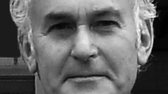
Profesor William Cartwright (1948) působí na RMIT (Royal Melbourne Institute of Technology), kde se specializuje na technologii nových médií v kartografii. Před zahájením akademické kariéry působil ve veřejném i soukromém sektoru. Bakalářský titul má z kartografie, magisterský získal v oblasti mediálních, informačních a komunikačních studií. Působil jako prezident mezinárodní kartografické asociace (ICA) a je členem komise ICA pro umění a kartografii (Art and Cartography).
Prof. Cartwright je členem redakčních rad významných časopisů, např: The Cartographic Journal, Transactions in GIS, Cartographica, The History of Cartography Project, Brazilian Journal of Cartography, aj. Více informací o této osobnosti kartografie naleznete na jeho stránkách.
Původní verzi rozhovoru naleznete na našich anglických stránkách.
Jaké největší změny podle Vašeho názoru ovlivnily GIS/kartografii za posledních deset let?
Jedná se především o používání Open-Source software a různých balíčků, které jsou vyvinuty na techto zákaldech. Další změnou je také nástup tzv. volunteered geographical information (VGI) a s tím spojená organizace občanů, kteří se těchto aktivit účastní.
Jaké změny nás podle Vaše názoru čekají v oblasti GIS/kartografii v následujícíh deseti letech?
Přesun do „všudypřítomných“ zařízení a tím dodávání prostorových informací na místa, kde jsou potřeba a kdy jsou zapotřebí.
Proč jste se rozhodl studovat kartografii?
Vždy mě zajímala grafika, začal jsem studovat, až když jsem pracoval v mapovém průmyslu.
Jaký atlas, nebo mapu, osobně obdivujete nejvíce?
Mapu londýnského metra.
Můžete jmenovat 3 nejdůležitější vynálezy v GIS/kartografii?
- Tisk
- Harrisonův chronometer
- Počítačové mapové aplikace (Computer-assisted mapping applications)
Jaký je největší rozdíl mezi západní a východní kartografickou školou?
Historicky jde o kulturní rozdíly, jak je zobrazována Země a vesmír. Přestože mechanismy tvorby map mohou být podobné, rozdíl je především v tom, jak jsou geografické informace zobrazovány.
Myslíte si, že moderní technologie přinesou nové vyjadřovací metody do kartografie, nebo se bude jednat pouze o redesign současných?
Koncepty jsou stále stejné. Způsoby sběru, analýzy, reprezentace a šíření map jsou dnes již implementovány v současných systémech.
William Cartwright is Professor of Cartography in the School of Mathematical and Geospatial Sciences at RMIT University, Melbourne, Australia, where he specialises in the application of New Media technologies to Cartography. He joined the University after spending a number of years in both the government and private sectors of the mapping industry. He holds undergraduate qualifications in Cartography and graduate qualifications in education, media studies, information and communication technology education and graphic design. He is the Chair of the Joint Board of Geospatial Information Societies and Immediate Past-President of the International Cartographic Association and a member of the ICA’s Commission Art and Cartography.
What do you think that has changed the GIS/Cartography in last decade the most?
The use of Open Source software and the rise of packages developed using this software. Also the advent of Volunteered Geographical Information and the related organization of citizens undertaking these activities.
What do you think that will change the GIS/Cartography in next decade the most?
The move to ubiquitous devices. Delivery of geospatial information ‚at location‘, that is where needed and when needed.
Why did you study cartography?
Always interested in graphics. Began studies whilst working in the mapping industry.
What atlas/map do you personally admire the most?
London Underground Map.
Could you name 3 most significant inventions, in your opinion, in GIS/Cartography ever?
- Printing
- Harrison’s chronometer
- Computer-assisted mapping applications
What are the main differences between western and eastern cartographic schools?
Cultural differences (historically) about the depiction of the Earth and the Cosmos. Whilst the mechanisms for map production and delivery might have been similar, the actual way in which geographic information is depicted is different.
Do you think that modern technology bring new methods of cartographic expression, or it will be just a redesign of those currently used?
The concepts are still the same. The means of data collection, analysis, representation and dissemination are allied to contemporary systems.
